

Archive Record
Images
Metadata
Catelogue Number |
A1418 |
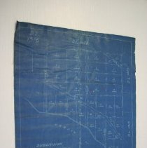
Object Name |
Map |
Date |
09/01/1915 |
Scope & Content |
1915 surveyor map of an area in Roberts Creek titled "Subdivision of Easterly Portion of District Lot 1316 Group One New Westminster District BC". Map shows lots on a section of the Strait of Georgia. The plans were found in the basement of the donor's house which had been located at 731 Dogwood Road since the house was moved to the current foundation in the early 1950s. The house is believed to be approximately 100 years old. Previous location is unknown, but the previous owner was a logger named Mark Ward whose nickname was "hightop" as he topped trees for a living. |